

3A - Landscapes and Landforms
Click on map to see larger image
Rationale:
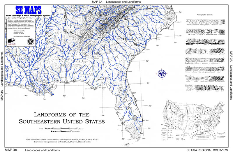
Landforms include all naturally formed physical features found on the surface of the earth. Some landforms are classified as constructional, being built up or deposited above the general land surface level, while others are classified as destructional, created by erosion into an older land surface. Each type of landform contains clues about the geologic processes and earth surface conditions that produced it. Groups of landforms that commonly occur together define broader categories called landscapes, which characterize the general topography of large expanses of land. Locations and drainage patterns of rivers, lakes, and streams can be explained by referring to localized distributions of landforms within a particular geographic region. The division of any large geographic area, such as the Southeastern United States, into separate landform regions serves as a convenient framework for referencing and correlating all of the natural and human processes that take place within its boundaries.
Themes
|
Content Outline
|
Activity TitlesAll activities include
|
|